Yellowstone to Glacier Through Central Montana’s Scenic Corridor
Posted March 29, 2021

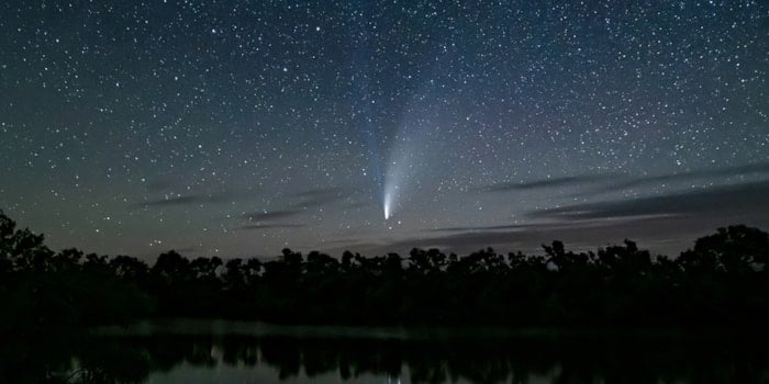
Sunset near Ringling
Looking for road trip ideas? Visit one or both of Montana’s national parks, take scenic US Hwy 89 between them and you won’t be disappointed. Limited traffic, small town charm, and plenty of things to do all combine for a memorable trip.
Let’s start where you exit Yellowstone National Park and work our way north to Glacier National Park.
Gardiner is the first town just outside Yellowstone’s north boundary. In about 55 miles US Hwy 89 connects with the interstate near Livingston. Don’t worry, in seven short miles on I-90 you’ll be able to get back to Hwy 89, a two-lane scenic drive pointing north.

Quilt sign on an old building near White Sulphur Springs
Cross the Shields River, enter the Shields River Valley and learn some history here – both were named after John Shields, an explorer and
member of the Lewis & Clark Expedition. The Shields River Valley is also known as the Valley of Peace, where traditionally warring Native American tribes would come and share the valley with no fighting. Next is Ringling, home of the Ringling Bar, known for good steaks and prime rib.
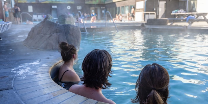
Further north, White Sulphur Springs, at an elevation of 5,045’, has thermal hot springs located in the Spa Hot Springs Motel. You don’t need to be a guest to soak, just pay a small fee and you can enjoy the calming waters. All pools are drained every night, 365 days a year, and no chemicals are used. Watch for quilt signs on barns, fences and retail stores from Ringling to White Sulphur Springs. You’ll find good food in White Sulphur Springs too, plus other lodging, camping, local stores, and a US Forest Service office for information about the national forest you are about to enter.

Memorial Falls in the Little Belt Mountains
Stay on US Hwy 89 and enter the 71-mile King’s Hill Scenic Byway. The Lewis & Clark National
Forest is on both sides of the highway and there are many hiking trailheads. When you reach King’s Hill Pass you are at 7,393’elevation and at the entrance to Showdown Ski Area, Montana’s oldest ski resort. While Showdown isn’t open in the summer, you can still hike the trails and runs for some amazing views. Porphyry Peak, a staffed lookout tower, is near the top of the chair lift at Showdown. Forest Service campgrounds are along the route with easy access.
Before you reach the town of Neihart, look for a brown trailhead sign for Memorial Falls on the east side of the highway. Stop, stretch your legs, grab your camera and take the short half-mile jaunt to the waterfalls. Best times to take this family friendly, handicap accessible hike are early summer to mid-autumn. Tip: take binoculars, even if you aren’t an avid bird watcher, because you’ll probably hear and see a nice variety of birds.
The boom-and-bust former mining town of Neihart, population 51, is next. Bob’s Bar and Motel is the primary business in town and locals make it a lunch or dinner stop. You’ll see remnants of mining history where silver and zinc were the motherlode of the day.

Hikers at Sluice Boxes State Park
After passing through the town of Monarch continue through a canyon and then arrive at Sluice Boxes State Park, named for the sluice box style of mining done in the area. A railroad once passed through this canyon hauling ore, and
now the rail bed is the main hiking access route through Sluice Boxes State Park. While there isn’t overnight camping, this park has excellent fishing in Belt Creek, unique hiking, floating and this writer’s favorite place for bird watching. Hikers need to cross Belt Creek for hiking so wear water shoes. The hike is worth it!
Not too far north of Sluice Boxes, Hwy 89 merges with MT Hwy 200 at Armington Junction. You’ll pass by the turn into the town of Belt (look for the butte that appears to have a belt around it) and in about 20 minutes you’ll be in Great Falls.
Great Falls, at 60,000 people, is the largest community you’ll see on this scenic park-to-park route.

Display at the C. M. Russell Museum
Must-see visitor attractions include the C. M. Russell Museum (Charlie Russell, America’s Cowboy Artist), the Lewis & Clark Interpretive Center overlooking the Missouri River, several other museums, River’s Edge Trail, a 60- mile urban trail following the river, and golf courses.
Hwy 89 runs through Great Falls, joins up with I-15 for about 10 miles, then begins the northwestern trek hugging the front range of the Rocky Mountains to Glacier National Park.
Be sure to stop in Choteau – the highway becomes the town’s Main Street. On the north end of town, you’ll think you stepped back in time when you see the massive dinosaur sculptures on the lawn of the Old Trail Museum. Stop, take some photos with the dinos, and then visit the museum to learn area history and how those huge dinosaurs once roamed this area.

Dino on the lawn at Old Trail Museum
Keep thinking dinosaurs because about 10 minutes north of Choteau is the town of Bynum, population 31. Another dinosaur greets you here in the parking area of the Montana Dinosaur Center (formerly Two Medicine Dinosaur Center). Paleo digs are offered here and the dino center is well-worth a visit.
The next town in the shadow of the rugged Rocky Mountains is Dupuyer – don’t worry, even some locals can’t pronounce it! Lodging, dining and a local specialty store tempt you to slow down and check it out.
For the next 30 miles you’ll gradually start to climb in elevation and get to Browning, elevation 4,376’, and home of the tribal headquarters of the Blackfeet Indian Reservation. You have choices here – point your wheels west on US Hwy 2 to drive the southern perimeter of Glacier National Park or continue on US Hwy 89 northwest and enter the park to drive the Going to the Sun road at St. Mary.
There you have it – two incredibly unique national parks and the scenic corridor that connects them.

Sculptures at the entrance to the Blackfeet Reservation
Happy travels!
Additional Resource:
Glacier National Park Travel Guide by Upgradedpoints.com
Recent Posts

August 3, 2023
Escape the mundane and travel south of the border for award-winning microbreweries, tiki bars with mermaids, live music in the…
Read More
May 30, 2023
Silence the noise, escape the hurry, and feel light years away in the dark skies of Central Montana – where…
Read More
July 7, 2023
If you’re looking for a place to expand your horizons, literally and figuratively, then Central Montana needs to be at…
Read More


