Elk Calf Trail
Choteau, Montana
About Elk Calf Trail
Length: 1.5 miles
Trail Begins: Trail Junction 133
Trail Ends: Trail Junction 101
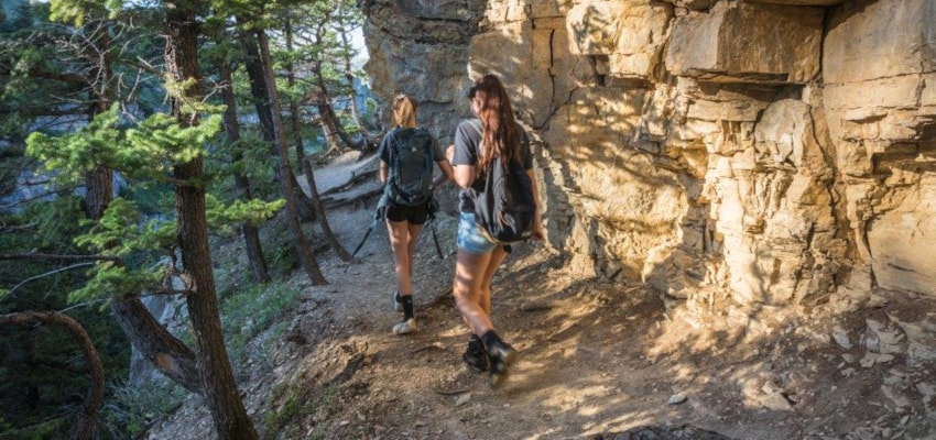
Elk Calf Trail (137) offers a scenic view of Glacier National Park. The Summit Cutoff Trail 133 climbs for 1.2 miles to the Two Medicine-Elk Calf Loop. The first portion of this trail is steep but usable. At the junction the decision must be made on which direction to proceed. If you plan to camp in the next two or three hours, take the two Medicine Trail 101.2 to better campsites on the creek. The Elk Calf Mountain Trail is not shown on the Summit topographic map.
Area Map: Lewis and Clark (Rocky Mountain Division)
USGS Map1: Summit
Township 30N; Range 13W; Section 28
Elk Calf Trail Activities
Bird Watching
Hiking
Horseback Riding
Nature Area
Picnicking
Sightseeing
Walking
Wildlife Viewing
Elk Calf Trail Amenities
Trail
Elk Calf Trail Reservations
About Elk Calf Trail
Length: 1.5 miles
Trail Begins: Trail Junction 133
Trail Ends: Trail Junction 101
Elk Calf Trail (137) offers a scenic view of Glacier National Park. The Summit Cutoff Trail 133 climbs for 1.2 miles to the Two Medicine-Elk Calf Loop. The first portion of this trail is steep but usable. At the junction the decision must be made on which direction to proceed. If you plan to camp in the next two or three hours, take the two Medicine Trail 101.2 to better campsites on the creek. The Elk Calf Mountain Trail is not shown on the Summit topographic map.
Area Map: Lewis and Clark (Rocky Mountain Division)
USGS Map1: Summit
Township 30N; Range 13W; Section 28
Elk Calf Trail Activities
Bird Watching
Hiking
Horseback Riding
Nature Area
Picnicking
Sightseeing
Walking
Wildlife Viewing
Elk Calf Trail Amenities
Trail
Elk Calf Trail Reservations
About Choteau, Montana

The Rocky Mountains soar near the town of Choteau, rising almost perpendicularly out of the northern plains. Choteau is the gateway to this spectacular stretch of mountains known as the Rocky Mountain Front. From Choteau, the Lewis and Clark National Forest adjoins the Bob Marshall Wilderness... ...
Learn More about Choteau