


Four Urban Trails in Central Montana
Posted May 9, 2020
Easily accessible, scenic and historic trails weave through several of Central Montana’s communities and offer a variety of recreation and scenery.
Lewistown Trail System

Lewistown Trailhead
The Lewistown Trail System has 24 miles of trail for walking and running. Find the trailhead on Main Street (211 E Main) in the business district. The trail system connects all of Lewistown’s public schools, a nice perk for kids and teachers who want to bike or walk to school.
Big Spring Creek runs through, technically under, Lewistown and a favorite section of the trail system in the Brewery Flats area is upstream about a mile out of town. To access this area take Highway 238 south of town. As Lewistown grew and spread out, Big Spring Creek was rerouted to make development easier. The mile-long stretch of trail in this area travels through what was once a brewery, a feedlot and a railyard.
A community effort in 1998 led to restoring the creek back to its original rambling style. The trail follows the creek in the area and is surrounded by 23 acres called Brewery Flats. This section of the trail system is named after the area – Brewery Flats Trail.

Sunset during an evening stroll in Brewery Flats
The trail is flat, perfect for all ages and abilities, and offers endless views of wildlife and nature. There are fishing access sites and good bird watching from the trail. Brewery Flats trail connects to the trail system that weaves through Lewistown.
The community is also building Creekside Pavillion on Main Street which will have public restrooms, a venue for outdoor events and green space.
There is a variety of lodging in Lewistown from the Yogo Inn, a conference hotel with dining and a lounge, The Calvert, a historic and beautifully restored hotel, and several others. A favorite morning fix for locally brewed coffee is Rising Trout Cafe on Main Street. Grab a homemade pastry with that coffee and you can burn it off on the trail! Big Spring Brewery is located in the old Central Feed building across from the Lewistown Trailhead and you can enjoy a variety of brews and food there.
Shelby’s RoadRunner Recreational Trail

RoadRunner Recreational Trail
Shelby sits at the crossroads of US Hwy 2 and I-15 about 35 miles south of the US/Canada border. It’s frequently a stop for travelers heading to Glacier National Park, 90 miles west.
The local trail here is the RoadRunner Recreational Trail. I’ve tried to figure out why it’s called that and I’ve been unsuccessful! The local high school team is named the Coyotes but no Road Runners!
The asphalt paved RoadRunner Recreational Trail is 5.06 miles long with two trail loop options – 2 miles or 5 miles. I’ve only been on the 2 mile loop but the vistas are endless. Short grass rolling prairie, wildlife, and views of the iconic Sweetgrass Hills northeast of town are amazing.
Shelby’s RoadRunner Recreational Trail has pet stations, benches, picnic areas, exercise areas and interpretive signs. It’s a hilly trail with some stretches lined with old-growth cottonwoods.
Area wildlife consists primarily of antelope (pronghorn) and deer.
After walking, running or biking the RoadRunner, stroll down Shelby’s Main Street in the evening and enjoy several old-time neon signs.
Morning coffee or afternoon blended drinks are excellent at Prairie Peddler on Main Street and you’ll find a large gift assortment there as well. Many other local shops, restaurants and bars line Main Street. Stop in and chat with the locals. Lodging is plentiful and the largest hotels are the Best Western Shelby Inn and Comfort Inn.
Great Falls River’s Edge Trail
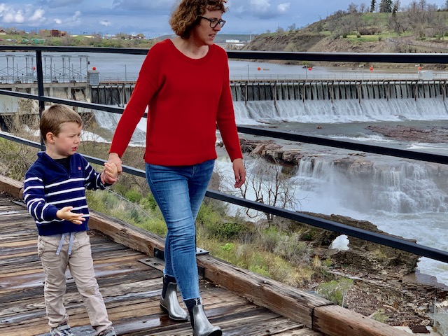
Strolling the River’s Edge Trail near Black Eagle Falls
The River’s Edge Trail in Great Falls is almost 60 miles long with about a third of it paved and the rest is single track. This trail follows the Missouri River as it flows through Great Falls and in most locations it’s on both sides of the river. As the trail reaches the east end of Great Falls it runs past the Lewis & Clark Interpretive Center, Giant Springs State Park and Fish Hatchery.
There are a series of waterfalls viewable from the River’s Edge Trail and my favorite to walk by is Black Eagle Falls, the most upstream waterfall. You can access the trail just upstream from Black Eagle Falls where a green caboose is parked, giving a nod to this former rail bed. There are multiple access points throughout the trail, picnic tables, restrooms, mileage markers and trailside art.
Not far from the green caboose on the trail is Great Falls Park & Recreation (1700 River Drive North) and they have free trail maps. Or, download a map on the trail website. There are interpretive panels detailing waterfowl and shore birds, old railroads that were in the area, history and wetlands.
Views from the North Shore of the River’s Edge Trail
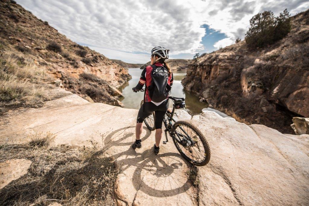
The River’s Edge Trail’s single track portion is a destination for avid mountain bikers. The trail meets IMBA standards and several races are held in this stretch. Terrain varies as you follow the trail – rolling plains, deep river canyons, waterfalls and hydroelectric dams. Crisp winter mornings will create a low-hanging mist over the river adding to the view.
Several hotels are located right on the River’s Edge Trail including LaQuinta Inn & Suites, Staybridge Suites and Springhill Suites. Some rent bikes and you can also rent from local bike shops or sporting good stores. Great Falls has plenty of other lodging options available to suit any traveler.
If you’re looking for some local coffee brews to start your morning, check out Morning Light Coffee or Crooked Tree Coffee. Quench your late afternoon thirst with a beer at local breweries including Mighty Mo, Jeremiah Johnson Brewing at MT Pints, or Black Eagle Brewery. If a handcrafted cocktail is your preference, stop by Enbar in downtown Great Falls.
Harlowton’s Smoking Boomer Rail Trail

Entrance to the Smoking Boomer Rail Trail
Next, let’s head to Harlowton and check out the Smoking Boomer Rail Trail.
Harlowton, a community of about 1,000 people, was once the terminus of an electric rail line. In the community’s business district there’s a small park with an E57B electric engine (it’s a great photo op). After the electric line closed, the Milwaukee Railroad was the next rail transportation going in to the community.
In 1940 a dog, later named “Smoking Boomer” became a mainstay at the Milwaukee depot and the roundhouse manager taught him to smoke a pipe. Fast forward to 2006 and the vacated rail line became the Smoking Boomer Rail Trail.
The trail is primarily gravel and is about 1.1 miles long, although the community is still working on it. You can park at what is now the Milwaukee Depot Museum, a treasure trove of rail history. If you have time, check it out and then go up the street to the

Deer along the Smoking Boomer Rail Trail
Upper Musselshell Museum and learn about the area’s dinosaur named “Ava”.
A couple of years ago I was in Harlowton and walked the Smoking Boomer Rail Trail in the evening. It really was one of those perfect evenings – warm but not hot, no wind and the most gorgeous sunset.
I saw several bicyclers and a few walkers with dogs, all leashed. The area was peacefully quiet until a few deer got scared by us humans and took off on a trot.
Four urban trails, all offering different scenery and a variety of challenges for non-motorized recreation, all are easily accessible in Central Montana. Time to get outside and explore!
Recent Posts
September 15, 2023
I’ve always felt it is hard to put into words how special Autumn in Central Montana can feel. Ther air…
Read More
November 1, 2023
If you are a wintertime outdoor enthusiast, then Central Montana should be next on your list for a cold weather…
Read More
September 2, 2025
You know a place I don’t hear about too often? Harlowton, MT! I knew it was a cool town, but…
Read More