Pondera County, Montana
Land Area (sq mi): 1,623
Est. Population: 6,158
Persons/sq mi: 3.8

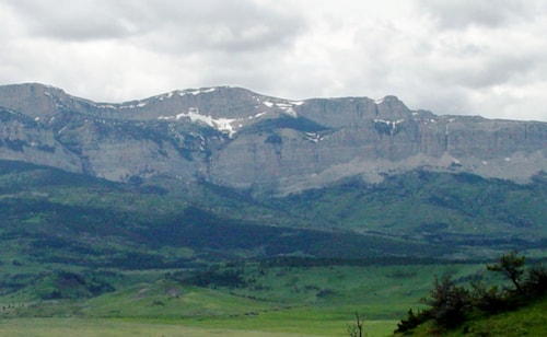
Pondera County (pronounced ponder-ray) is almost rectangular shaped, running east and west. The county’s terrain varies from flat and rolling plains to mountains that reach the Continental Divide in the Rockies. A portion of the Lewis & Clark National Forest is in the county along with part of the Blackfeet Indian Reservation. The total area of Pondera County is approximately 1,623 square miles, Conrad is the county seat and population is 6,211.
The primary economic driver in the county is agriculture. Pondera County is part of a region of Montana referred to as the Golden Triangle because of all the wheat grown in the area. Wheat, barley, hay, lentils, peas and oilseed crops (such as canola) are grown here alongside cattle ranching.
Highway routes to Pondera County include US Hwy 89, Interstate 15 and MT Hwy 44. Conrad has a paved landing strip airport and Valier has a grass landing strip for small aircraft.
Communities
in Pondera County
Headed to Pondera County, Montana? Get to know the communities found in the county! When planning a trip across Central Montana, remember that not all of our communities offer full services and you won't always have cell service.


Lake Frances at Valier provides year round recreation including boating, fishing (walleye, perch, Northern pike), wind surfing and water skiing. Locals organize a winter ice fishing derby and a summer fishing derby. When at capacity, the lake is 5 miles long and 2 ½ miles wide covering 5,300 acres. Water from Lake Frances also finds its way through 450 miles of canals and lateral ditches to irrigate local crops, and to provide water for the town of Conrad.
Once area grain crops are harvested the remaining “stubble” provides good forage and cover for upland game birds (pheasant, Hungarian partridges, grouse). Bird hunters praise the area for excellent hunting.
The Pondera Golf Club, open to the public, is located north of Conrad with 9 unique holes of golfing.
Just west of Dupuyer visitors will find great hiking access into the Rocky Mountain Front. Swift Reservoir and Swift Dam near Dupuyer sit at the base of the Rocky Mountains, fed by Birch Creek. The dam was originally constructed in 1910 and gave way in June 1964. A new dam was completed in 1967 which is 205’ high and 573’ wide. The water is managed by the Pondera Canal & Reservoir Company.
Events
in Pondera County
The charming communities found throughout Montana's Pondera County cannot wait to welcome you to some of their favorite annual events. While there's so much to see and do in Central Montana, this is a quick hit list of Pondera County's annual events.