
Meagher County, Montana
Land Area (sq mi): 2,392
Est. Population: 2,116
Persons/sq mi: 0.9

Meagher County (pronounced "Mar") covers approximately 2,395 square miles and has a population nearing 1,900. White Sulphur Springs, the county seat, is located about 3 miles southwest of the junction of US Highways 12 and 89. Other communities in the county include Martinsdale, Lennep and Ringling. The county was named for Thomas Francis Meagher, Irish revolutionary and acting governor of Montana territory.
Initial settlers came to the area in search of ore. Copper, lead and silver exploration kept the county bustling. Today there is little ore exploration although a future copper mine is undergoing permitting.
Communities
in Meagher County
Headed to Meagher County, Montana? Get to know the communities found in the county! When planning a trip across Central Montana, remember that not all of our communities offer full services and you won't always have cell service.


Recreation opportunities can be found year round in Meagher County. The Little Belt and Big Belt Mountains, Castle Mountains and Crazy Mountains almost surround the county with the Smith River running through the center. The Smith River is a premier float and fishing river (permit only) and finds its way on to many recreationists’ bucket lists. The various mountain ranges are part of the Lewis & Clark and Helena National Forests. Travelers seek out White Sulphur Springs to soak in the town’s namesake, the hot sulphur springs open year round. Camping, mountain biking, hiking, bird watching, wildlife watching, floating and fishing are top summer activities. Fall season finds hunters in search of big game including elk, deer and moose. Once the snow falls, Meagher County becomes a skier and snowmobile haven. Kings Hill Pass, at the top crest of US 89, is where Showdown Montana Ski Area is located. Showdown receives an average annual snowfall of 255 inches, has 640 acres of skiable terrain, 34 trails, 3 lifts and a learner’s conveyor course. Mountain elevations vary between 6,000 and 8,000 feet. Snowmobilers have 325 miles of groomed trails in the area.
A 71-mile stretch of US Hwy 89, running north and south through Meagher County has been designated the Kings Hill Scenic Byway. Mountain streams, hiking trails and gravel roads lead from the main highway offering access to phenomenal recreation. A ranger district office of the Lewis & Clark National Forest is located in White Sulphur Springs with maps and information available about the area.
Fishermen seek out Bair Reservoir, Lake Sutherlin, Martinsdale Reservoir and Newlan Creek Reservoir for year round fishing opportunities. The Musselshell River, Smith River and numerous small mountain streams tempt anglers in the summer.
Attractions
in Meagher County
While visiting Meagher County you may be wondering what to do in the area beyond enjoying Central Montana's incredible wide-open spaces and outdoor recreation. Here are some of the can't miss attractions in Meagher County!
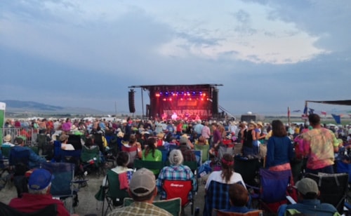
White Sulphur Springs is the largest community in Meagher County. Motels, campgrounds, restaurants, bars and shopping can all be found. The Castle Museum (including a display of carriages) is located in White Sulphur Springs. It was built by Byron Sherman as a home and is now operated as a museum and open during summer months. Rodeos, fishing derbies and the Red Ants Pants Music Festival also draw visitors to town.
Lennep is located in the southern part of the county in beautiful ranching country. The iconic Lennep church is the subject of many photographers but today little exists in this former town. Bonanza Creek Country, a nearby guest ranch, offers traditional ranch activities for visitors.
Martinsdale has become known for the Bair Family Museum which is located a mile from town. At one time Charles M. Bair was the largest sheep rancher in Montana and his home and many artifacts are open seasonally for visitors. There is lodging in Martinsdale and one restaurant (voted best pie in the state).
Ringling was named for one of the owners of Ringling Brothers Circus. Ironically, two main buildings in town are the Ringling Bar and St. John’s Catholic Church.


